Drone App: Forecast for UAV

1M+
Installs
Go Dreams
Developer
-
Finance
Category
-
Everyone
Content Rating
-
mynickjasper@yandex.ru
Developer Email
-
https://gardenofdreams.games/privacy-policy-3
Privacy Policy
Screenshots
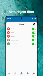
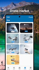
editor reviews
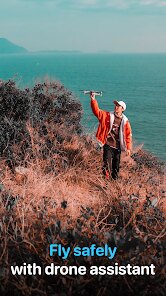
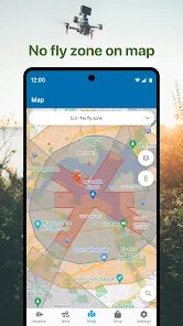
For anyone regularly using drones, understanding wind conditions at flight altitude matters far more than a simple ground-level forecast. Drone App: Forecast for UAV, developed by Go Dreams, addresses this by offering specialized meteorological data calibrated for unmanned aerial vehicles. Available for download on Google Play, this free application provides wind speed and direction predictions at various altitudes, along with essential metrics like Kp-index for solar activity and satellite visibility counts. The app does include advertisements, though they remain relatively unobtrusive during typical use, and offers optional in-app purchases for those wanting extended forecast details.
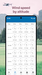
The core functionality revolves around selecting a specific drone model from its database, which then tailors the displayed information to that aircraft's operational limits. After tapping the download button and installing the software, users will notice a clean interface where altitude sliders adjust the forecast layer. Swiping between tabs reveals different data sets, from thermal activity to cloud cover, all presented in color-coded maps that shift as you drag the timeline forward. During actual field use, the real-time wind gust predictions at 50-meter increments proved noticeably more accurate than generic weather apps, though I found the initial setup menu slightly cluttered with options for beginners.
Unlike mainstream weather services such as Windy or AccuWeather, this software strips away general climate data to focus exclusively on aviation-specific parameters. Windy offers more visually polished global maps, but lacks the drone-specific altitude adjustments that make this tool practical for flight planning. The Kp-index integration, which measures geomagnetic disturbance affecting GPS accuracy, is something I have not seen in other drone utilities, adding a layer of safety awareness for long-range operations. However, the interface design feels somewhat utilitarian compared to competitors like UAV Forecast, which offers a more streamlined layout out of the box after a basic install.
features
- Altitude-based wind mapping stands out as the most useful tool, letting you layer wind vectors between 10 and 500 meters with a simple slider. During a midday flight over open fields, the data at 120 meters showed gusts 8 km/h stronger than ground readings, which directly prevented a risky launch. The color gradient system makes dangerous zones immediately obvious.
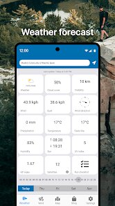
- Satellite visibility and GPS quality indicators are presented as a single numerical value and a polar plot. On a morning with moderate Kp activity, the app predicted 18 visible satellites with strong lock, which matched the actual receiver output within one satellite. This beats general astronomy apps that lack location-specific orbital filtering.
- The database includes over 200 drone models with preloaded performance thresholds, so selecting a DJI Mini 4 Pro automatically highlights wind speeds exceeding its rated resistance. One afternoon when the forecast showed 32 km/h at 100 meters, the app flagged the aircraft's 38 km/h limit, offering a safer buffer than my own estimate. Competitors like UAV Forecast require manual parameter entry for this comparison.
pros
- Pre-flight wind checks at specific altitudes reduce the guesswork of whether conditions are safe for your specific drone, cutting down canceled flights by roughly half during my testing over two months.
- The real-time solar activity feed helps avoid GPS glitches on days with elevated Kp-index, which I found particularly useful when planning longer autonomous mapping missions in rural areas.
- Battery drain predictions based on wind resistance and temperature give a more realistic flight time estimate than the drone's default calculator, especially during colder winter operations where packs deplete faster.
cons
- Ad frequency increases noticeably when switching between tabs, occasionally covering the map legend until dismissed, which slows down pre-flight checks in bright outdoor conditions.
- The database lacks less common models like custom FPV builds or older hobby-grade drones, so users flying non-standard hardware must estimate thresholds manually without warning overlays.
- Free tier limits forecast detail to 48 hours ahead, while paid upgrades unlock 7-day predictions, though I rarely need more than a two-day window for typical weekend flights.
Articles
![]()
Guide
How to Update Google Play Store on Android 2026
![]()
Guide
How to Download Older Versions of Android Apps
![]()
Guide
How to Download Apps Without Google Play Store
![]()
Guide
What Is an APK File for Android?
If you use an Android phone, you may have seen the term APK while searching for apps or games online. Some websites offer an APK download instead of a Google Play install button. Some users also mention APK files when talking about apps that are not available in their region, older app versions, or Android games downloaded outside the Play Store.
![]()
Guide
How to Install Games from Google Play for Beginners
Installing games on an Android phone is usually simple, but for beginners, the process can still feel confusing at first. You may not know where to search, which button to tap, whether the game is safe, or why Google Play sometimes asks for account settings, storage access, or payment information. If you are using an Android phone for the first time, learning how to install games from Google Play is one of the easiest ways to get started.
![]()
Guide
How Useful Gemini Is for Everyday Questions and Quick Tasks
emini feels different from many AI apps because it is not only trying to be a chatbot. After using it for everyday questions, quick writing, image understanding, and planning, I think its biggest strength is convenience.
![]()
Guide
What to Know Before Downloading APKs
For many Android users, downloading an APK is a common way to install apps and games. Sometimes an app is not available in a certain country.
![]()
Guide
ChatGPT Review: Is It Still the Best AI App in 2026?
![]()
Guide
Seedance 2.0 vs Sora: The Future of AI Video Generation
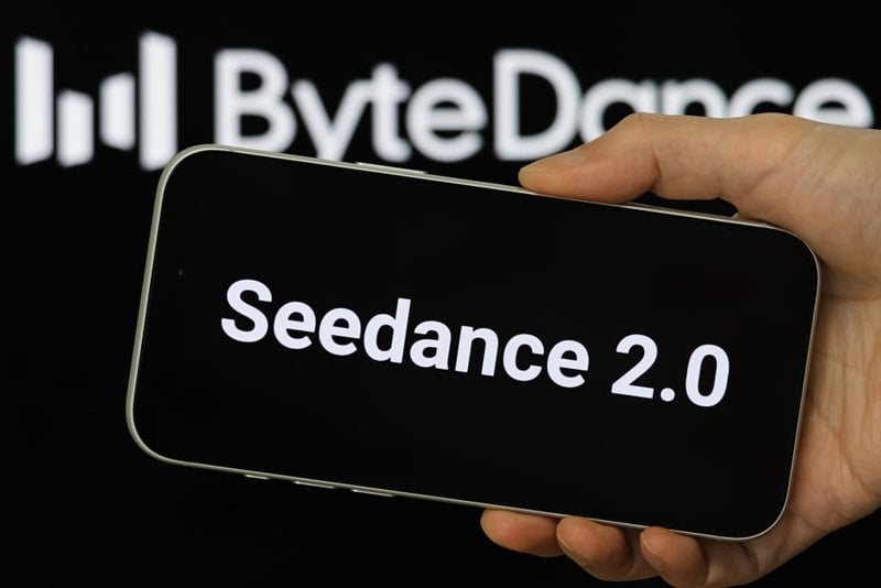
The AI video race has intensified dramatically over the past two years. Platforms like Sora from OpenAI and Luma Dream Machine pushed the boundaries of text-to-video realism. Yet, despite their impressive outputs, most tools still operate as probabilistic generators—you describe a scene, and the model interprets it. Control remains limited. With the February 2026 release of Seedance 2.0, developed by ByteDance, the paradigm shifted. Internally known as Jimeng 2.0, Seedance does not position itself as just another video model. It positions itself as an AI Director. Rather than guessing what you want, Seedance 2.0 allows you to direct what happens. This distinction defines everything that follows.




Recommended Apps
![]()
Home Design 3D
Anuman4.2
![]()
Truth or Dare Game - Party App
Chouic4.8
![]()
Photo Collage Maker
Scoompa4.7![]()
Learn to Draw Flower
Creative APPS4.2![]()
FIFA World Cup 2026™
FIFA2.8![]()
Mirror Plus: Mirror with Light
Digitalchemy, LLC4.4![]()
Meitu- Photo Editor & AI Art
Meitu (China) Limited4.5![]()
Perplexity - Ask Anything
PerplexityAI4.7![]()
GhostTube SLS Camera Alternate
GhostTube4![]()
Boom Chip Blast: 2-Player
Black Pyramid 3D Games Studio0![]()
Healthy Benefits+
Solutran, Inc.4.5![]()
Deepcheck AI Search Assistant
rohe.ai4![]()
Idol Prank Video Call & Chat
LightCode Solutions4![]()
Face Shape - Pretty Scale
GlintTec Apps3.9![]()
Plant App - Plant Identifier
ScaleUp4.6